Management & Maintenance: luxData.pro
Complex facilities. Expertly managed.
Professional infrastructure and facility management based on over two decades of municipal experience. Maintenance, troubleshooting, billing, and documentation are all integrated into one system: every light fixture, every cable, and every control panel in one place.
Operational management tailored to professional needs, at a glance:
Everything you need. One click.
Which light fixture is attached to which control cabinet? What type of lamp is installed, and how often? luxData answers operational questions without requiring any database knowledge. The answers come directly from the running system.
Operations & Maintenance
You can efficiently handle maintenance, repairs, service calls, and billing. Every process is thoroughly documented.
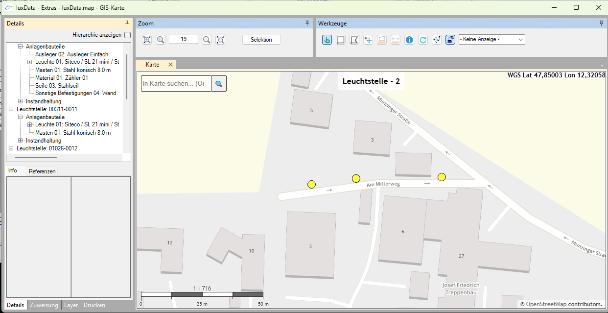
Integrated Map (luxData.map)
All facilities are shown on the map. Many basic functions can be launched directly from the GIS view .
Queries & Statistics
The query generator creates reports from any data field. You don't need any SQL or database knowledge to do this.
Form Designer
Customize forms on the fly: Show and hide fields, enable write protection, and set permissions down to the field level.
Complete History
The status of each facility can be traced back to its construction or initial registration.
Users & Permissions
Flexible user groups and data filters are available. Permissions and visibility can be precisely tailored to locations, areas, and fields.
Image & Document Archive
Save images and documents in all common formats directly to attachments and tasks.
Interfaces: GIS & SAP
Integration with all common GIS systems, as well as intelligent SAP interfaces for the material master and order processing.
Developed from local government experience.
Municipalities & Cities
Operate street lighting cost-effectively, document traffic safety obligations, and plan the budget using reliable figures.
Municipal Utilities & Energy Providers
We manage lighting operations on behalf of many municipalities. The system is multi-client capable and includes billing functionality and an SAP integration.
Industrial & Business Parks
Manage outdoor lighting for large areas. To do this, use the same tools as in municipal operations.
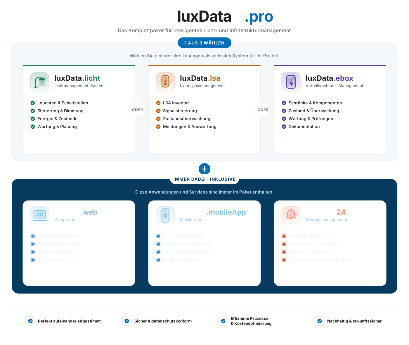
A system with everything you need.
luxData.pro grows with your needs: modules, interfaces, custom extensions, and services—all from a single source.
Add a control?
luxData.pro can be expanded to include control functionality: luxData.connect as a standalone, vendor-neutral control system, and/or luxData.control to integrate existing systems such as eSave or Interact via API.
Looking for an easy way to get started?
If you just want to start by collecting, documenting, and working on the map, luxData.easy is the faster option—and you can switch to luxData.pro without losing any data as soon as you need more features.
Get to know luxData.pro in person.
We'll show you how the system works using your own use cases. This is a no-obligation, straightforward process.